
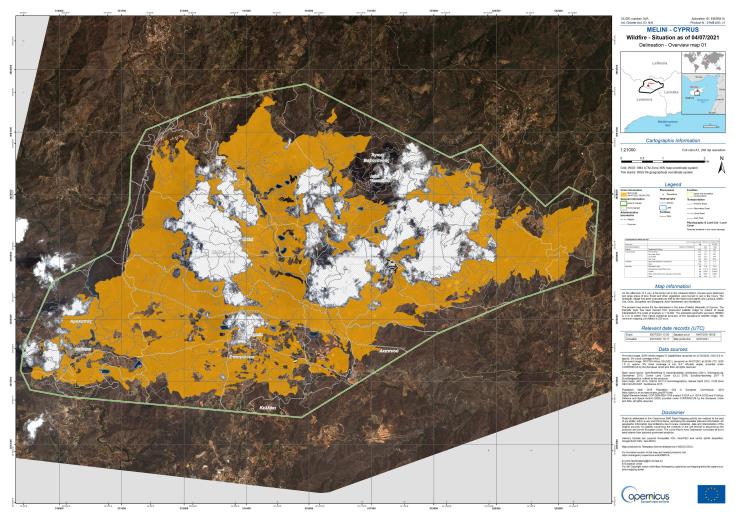

Specifically, the data published by the Commission`s satellite mapping service via Copernicus satellite so far record 3134 hectares of burnt land, 347 burnt residential buildings, 2,366 hectares of forest and 2,482 hectares of agricultural land.
According to the relevant service of the Commission that receives and publishes the data from the satellite, “on the afternoon of 3 July, a fire broke out in the Limassol district. Houses were destroyed and large areas of pine forest and other vegetation were burnt in just a few hours. The Arakapas village has been evacuated as well as the district boundaries into Larnaca, Melini, Ora, Odou, Sykopetra, and Eptagonia, Ayioi Vavatsinias, and Vavatsinia.”